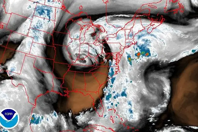
The weather forecast from earlier this week remains mostly on track, with a high pressure system to our north fighting off the advance of a cut-off low over the Ohio Valley. So far the high is keeping the worst of the rain away from the city but we should still see plenty of precipitation over the next few days, with the greatest amounts staying to the east of the city.
In addition to the rain it is going to be windy this afternoon and evening as the atmosphere tries to even out the pressure differences between the high and low. Look for northeasterly winds at 20-30 mph, with gusts reaching 40-45 mph along the shore, this afternoon diminishing to 10-15 mph tomorrow. The wind, rain and heavy cloud cover will keep today's temperature steady at around 60 degrees. Saturday is expected to be a bit warmer with a high near 65.
The cut-off low is not in a hurry to go anywhere but by spinning in place for days on end it is drawing dry air into itself, ensuring its eventual demise. Sunday will still be mostly cloudy with a passing shower or two and a high in the upper 60s. We may hit 70 on Monday with the sun peeking out between the clouds later in the day.
Meanwhile, down in the Caribbean, Matthew has rapidly strengthened into Category 3 Hurricane. The storm is expected to take a northward turn over the weekend and be very close to Jamaica by Monday morning and over the Bahamas by Wednesday. It is way too early to know with any confidence what path the storm will take late next week but the latest model runs generally have it curving out to sea.