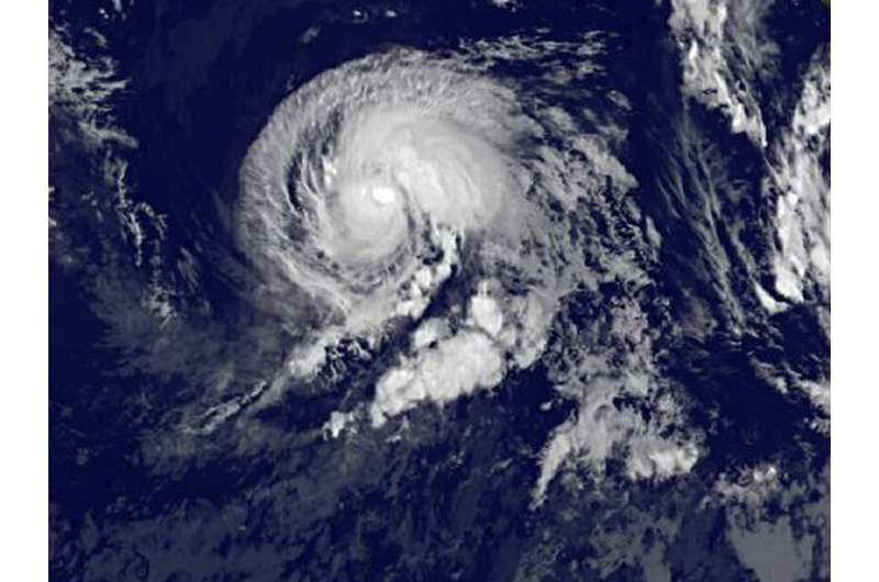
NASA sees Tropical Storm Irwin getting in better shape

Everyone likes to get in better shape and that's what's happening with Tropical Storm Irwin. Irwin appears much more organized on infrared satellite imagery and there's a hint of an eye developing.
Irwin developed on July 22 as Tropical Depression 10E, about 595 miles (960 km) south-southwest of the southern tip of Baja California, Mexico. By 5 a.m. EDT on July 23, the depression strengthened into a tropical storm.
NOAA's GOES-West satellite captured an infrared image of Tropical Storm Irwin on July 24 at 8 a.m. EDT (1200 UTC). The image revealed a better organized tropical cyclone. The National Hurricane Center (NHC) noted at 11 a.m. EDT on July 24, "Irwin's structure continues to improve, with the low-level center embedded beneath a CDO (central dense overcast) feature that has persisted for the past several hours. In addition, recent microwave data have revealed the formation of a mid-level eye."
NOAA manages the GOES series of satellites, and NASA uses the satellite data to create images and animations. The image was created by the NASA/NOAA GOES Project at NASA's Goddard Space Flight Center in Greenbelt, Maryland.
At 11 a.m. EDT (1500 UTC) the center of Tropical Storm Irwin was located near 14.8 degrees north latitude and 117.5 degrees west longitude. That's about 750 miles (1,205 km) southwest of the southern tip of Baja California, Mexico. Irwin is moving toward the west near 3 mph (6 kph). A slow, generally westward motion is expected during the next couple of days. The estimated minimum central pressure is 999 millibars. Maximum sustained winds have increased to near 60 mph (95 kph) with higher gusts. Additional strengthening is forecast during the next 48 hours, and Irwin is expected to become a hurricane tonight or on Tuesday, July 25.
NHC said "Since it appears that Irwin is developing a well-defined inner core, it is likely well on its way to becoming a hurricane."
Provided by NASA's Goddard Space Flight Center


